Tuesday, August 31, 2010
Monday, August 30, 2010
Panoramas from the trip
 i think this is just south of the Lost Coast area
 a point at mendocino headlands park - some messed up areas b/c waves keep moving as you stop to take the next shot in the panorama
 another cove in mendocino
 a cove/coastline in Mendocino -about 9 in the morning
thought i took more, but these are the only 4 i took apparently
Monday, August 23, 2010
Day 9: Headin home
 Last shot before the battery died, lookin like a badass
 More amazing coastline
 McWay Falls
Got up and out of camp by around 8 am. Went to Julia Pfeiffer Burns SP and checked out McWay Waterfall – an 80 foot utopian waterfall into a cove on a beach with the blue-est/greenest water we’ve seen. Incredible. It takes 5 minutes to hike out to the waterfall. No access to the beach the water falls onto, in order to keep it pristine, which is pretty awesome. There are two camp spots near the top of the falls, that are free, but you have to reserve it a year in advance we heard. We drove south stopping here and there, and then stopped to eat at Whale Watcher’s Café- it was eh. We stopped just north of Morro Bay and saw elephant seals- ginourmous seals that make the craziest noise-sounds like a diesel boat. The camera had finally died, so no pics of them. Then we stopped in Morro Bay and walked around for a while. It seemed like a pretty cool town, but a bit touristy also. The coast was definitely the coolest to the north of Morro Bay. Once south it was still cool, but just not as cool as it had been on the coast north of Morro, and up the coast. Stopped at a food co-op in Santa Barbara to get some food, and ate on a beach there and hung for a bit. Then we went ahead and made the drive home. It was a pretty insane, new, unique, exploratory vacation for both of us. Can’t wait to do it again somewhere else!
Day 8: Big Sur
 chuck was getting pretty dirty by this point, but we were still smilin!
 driftwood shelters ont eh left, amazing scenery everywhere
 thumbs up!
 view along the drive
 stoppin at scenic points
 morning stop
Woke up after a surprisingly good sleep in the car and headed to Monterey. We used a book we had and read about a city called carmel by the sea , which was close by, and was supposed to be nice and cute and unique. So we stopped there for coffee and hot chocolate. We drove on to Andrew Molera SP and arrived at 8:15. This is a no reservation camp site ($25) and it was Friday so we didn’t know what to expect. There were already two women in line to get camp spots, and the ranger told us we had to basically wait until people left from the day before to get their spot. So I got in line, and it actually only ended up being about 30 minutes before all three of us had spots! There were four others behind us by then too, so spots fill quickly (only 25 spots total I think?). We set up camp and noticed all the little squirrels everywhere- the ranger told us some kids got their keys taken by the squirrels into their holes the day before and couldn’t get them back. There’s food lockers here basically just because of squirrels, crazy. We drove down to Pfeiffer Big Sur SP and hiked to Pfeiffer Falls (about a mile) and hung out there for a while, before heading back to our camp spot. It’s about a half mile hike to the camp spot, and then another half mile to a beach! Pretty awesome spot with a little cove. People were surfing here, which would make it a pretty awesome spot to stay at. We just hung out and relaxed ont eh beach for the afternoon. Took a walk also, and checked out all these little driftwood shelters people have made. We went back to town for a minute in the evening and got some supplies, and then came back to eat an awesome meal – rice, beans, corn, peppers, and garlic, cooked over the fire, with some good beer, then topped off with smore cookies.
Friday, August 20, 2010
Day 7: Whitewater rafting!

Sunset in gold country
 Hell's Hole! click to enlarge! there's actually seven people in the boat! front right is getting wet!
 sunrise over Lewiston Lake
Woke up to tons of bird noises and an insanely quiet, glassy lake. Walked around a bit and headed to Big Flat to white water raft! We made reservations the afternoon before here and were super excited! We went to Trinity River and chose Wilderness Adventures. We got 10% for going during the week, so it was only 75 bucks each for a full day! Pretty pumped, cuz other companies seemed to be more around 100 bucks for full days. We headed out at 9:30 I think and were with two other couples (in their 40s and 50s, and seemed pretty cool) and the guide, Ronnie, who grew up there. We got going rafting and I could tell Mel was nervous. We were in the back though so we were ok I figured. At the first rapids, the lady up front got bumped out, but handled it. The rapids were pretty scattered throughout the river, and pretty fun. All class I through III rapids, so nothing to scary or dangerous or anything. It was super hot here, making it the first spot on our vacation where we were hot. The water was really cold so it felt awesome and we could jump out of the raft here and there to cool off. We saw a ton of fish and even a bald eagle! Lookin proud as ever. The best rapid was Hell Hole – a 10 or 12 foot drop over some big boulders. The whole raft was vertical when we went over, and it totally filled with water in the landing! We all stayed in and I wished we could do it again. We stopped for lunch right after it and got to watch many others go over it which was hilarious. The lunch spread was insane. Lots of fruit and veggies with dip for an appetizer. Then a full deli spread with veggie patties, and tofu, and then every veggie you could think of to put on the sandwich, alogn with cheeses. Drinks too. Mel and I stuffed ourselves, for sure more than the others were, but I didn’t care. Then we got dessert- strawberries with chocolate sauce and some coconut ball things. Seriously, the food was incredible. The only thing that was bad was that there were a lot of leftover veggies, fruits, and stuff from the deli spread, and it all got tossed! Both Mel and my jaws dropped when we saw him dump it into a trash bag. We seriously stuffed ourselves so there was no way we coulda eaten more, which was good, but still, we wished they woulda saved all that somehow. We continued on and finished our trip around 3, a bit early, but we were beat. Then we cruised back through Weaverville, got more ice cream, and headed south! We decided to go to Big Sur next, because we didn’t know what to do up north and inland. The highway felt good as it was nice to be on a straight road. The sunset along the way was nice too. We thought about staying at Clear Lake that night, but realized it was a bit too far out of the way, so we pressed on. Then we almost camped at another lake, but it was super windy when we pulled up so we headed onward! We finally stopped in a parking lot in Monterey and slept in the car because there weren’t any camp spots we knew of anywhere nearby. It was late so we both ended up sleeping really well so it was actually ok, not ideal, but ok.
Day 6: Headed Inland
 Lewiston lake after sunset
ice cream in weaverville! best single scoop deal ever!
 beach view, not the sunniest, but one of the coolest
 beach with pines and redwoods right up against it
 arch in a rock on the beach
 about to walk down to the beach
We woke up and walked around on the beach watching some guys fishing. Thought about getting in the water, but it was freezing! The water, rocks, beach, wood, and trees right here are really awesome. After breakfast, we headed south and inland on the 299. It’s a pretty windey, pretty road, in between mountains covered in pines, and along the Trinity River for most of the way too. We got to a small town called Weaverville around 2ish, and got the details on our campspot for the night over the phone. We had some time, so we hung out in Weaverville for the afternoon and ate, got ice cream, and some food for dinner later. It’s a pretty awesome town and was nice for a relaxing afternoon. We got to Mary Smith Campground by 5 and got a spot. We were 20 yards from the waters edge of Lewiston Lake. No large motors allowed on the lake, so it was perfectly calm and quiet. There are other campspots around you here, but they’re spread out enough. We walked around the lake for a minute on a small trail and then headed back to eat! Made chili with rice over the fire and looked at some potential spots for tomorrow night’s spot. The mosquitos were around here, but we had some spray so it wasn’t bad. We made incredible chocolate chip sandwiches with roasted marshmellows int eh middle. So good! We were under scattered trees here, so we went to bed without the fly on the tent and the stars and moon were so awesome! Super pumped on the screen walls of the tent for this reason.
Thursday, August 19, 2010
August 3, "day 5, he does dishes" she says
 The Pizza King
 Fern Canyon Loop
 Fern walls!
 massive, natural destruction
 fern canyon trail
 crossing the creek
 banana slug- an integral part of the forest
 james irvine trail
 getting goin
got up and headed to Prairie Creek redwood state park and ate some breakfast. We hiked the James Irvine Trail (4.6 mi) to the Fern Canyon Loop (1 mi). THe James Irvine trail is pretty sweet- you're hiking a trail with many little bridges over creeks, some switchbacks, and you're
up along ridges most of the way. THis provides a great view even at eye level. THe forest here is so dense! Only saw maybe five others on this trail. Fern Canyon Loop is an easy loop, but absolutely insane. the main part of hte loop is thorugh a canyon along a creek= the canyon walls are at least 60 feet high and covered in ferns, making for very incredible walls on both sides of you. the trail has small wooden boards to criss cross the creek as you hike too. we heard some of Jurassic Park was filmed here because of the crazy scenery. THis trail is easily accessible from hte other end so this trail was pretty crowded. It starts right at the beach though too, and we read there are some good waterfalls only a mile away that fall onto the beach. We saw a huge male elk here too, with an awesome rack! we then hiked back up the loop to the james irvine trail and made it a loop by cutting over on the Clintonia Trail to the Miner's Ridge Trail, both
equally as impressive as James Irvine Trail. We were pretty beat at this point though, so it was a bit more of hiking to get back to the car, but we still enjoyed ourselves along the way. After this, we headed up to Crescent City and checked on a couple camp sites at their city visitor center. they told us that one site we were considering is insane with mosquitos (Lake Earl) so we decided against that one. We ate at the Pizza King, which was super good and cheap, so ifyou're in the area hiking or camping, this is a good spot to check out. then we went to our camp spot trailhead, Nickel Creek Walk-in. Its about a half mile hike to camp,which is an awesome hike up along a cliff at the edge of the ocean. The camp is by a creek that empties to the ocean so its in a small valley and only about 100 yards from the beach. THe beachhas an aweomse little arch in a rock, lots of driftwood, and tidepools during low tide. THis spot is free, with no reservations, but you're supposed to get a permit now for free, but we didn't have one and it wasnt' a problem. there's five sites, which are all pretty big and can fit a few tents each it seemed so sharing sites would be easy. the sunset here was awesome tonight-our first along the coast where we could see it actually (no fog, trees, or hills blocking it). we made a fire with driftwood, but mel went to bed early and i followed after a while. awesome, exhausting day.
Wednesday, August 11, 2010
Day 4: Mel's Birthday!
 signs of a recent bear! fine print at the bottom: "a fed bear is a dead bear"
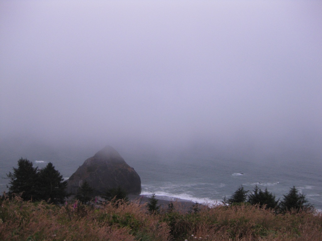 view from where you park to hike in to flint ridge camp
 birthday dinner in the car! overlooking a beautiful foggy ocean.
 elk across the 1 from the visitor center
 beach that the redwoods national park visitor center is on
 fallen down tree-this is the underside of the roots! along the buck creek trail
 hiking in humbolt redwoods along the tall grove trail
 beautiful sun up high in the lost coast as we left our camp spot.
Got up to beautiful sunny skies because we were above the clouds that were at sea level. On our drive out of the lost coast we saw a mountain lion just trottin down the road as we came around a corner. He was too quick to catch a photo of though. We headed to the avenue of the giants in humbolt redwoods s.p. which is ridiculous! So many redwoods and so many other trees- very dense! Almost immediately we saw a wild peacock on the side of the road just walkin along. We hiked buck creek trail and the tall grove loop too. Tall grove loop is really quick, .5 mile loop but it’s pretty awesome as you’re first introduction into redwoods. The buck creek trail is cool, as it’s along a creek the entire way, but the creek wasn’t flowing much while we were there. Maybe more in the spring? Then we drove north, stopping to get treats in Arcata, and then stopping at the redwoods national park visitor center! There were elk there to greet us too! Across the street is an area where they just hang out a lot I guess-probably about 20 of them just lounging around, eating and looking back at us. Then we went to our camp spot – flint ridge walk-in. Here you park on an ocean cliff, and hike a half mile into the camp. The camp is very secluded, but you can hear the waves down below, so that’s cool. There’s 11 sites? And its’ free, along with it being free to be in the redwoods park, which is awesome. There were signs saying a bear had been seen in the camp getting left out leftovers, so we made sure to pack everything up properly. When we pulled up to this spot also, we ran into a guy hiking the entire pacific coast trail! Go to Trailbums to check them out. He pointed out to us a bunch of grey whales down in the water. It was super foggy, but they were so close to shore you could still see them! It was awesome. Recap: I arranged for a mountain lion, peacock, elk, and whales to say hey to Mel for her birthday. we were so exhausted that night from teh day's activities that i don't think we even bothered making a fire; we just crashed.
Day 3: August 1st

scarfin down dinner at our lost coast spot: tolkan camp
 not a fish
 river we stopped off at
 fog burning off along the coast
mendocino headlands park
Woke up and headed north in more crazy fog. We stopped in Mendocino Headlands Park and ate on some cliffs overlooking a few coves and rocky areas in the ocean. Then we headed up the coast on the 1, stopping here and there for some views. Definitely the most insane road we’ve ever been on, and maybe the most insane scenery we’ve ever seen. It’s incredible.
Once we got to the Lost Coast where the 1 is directed inland, we ended up seeing an awesome river to jump in. we hung out here and swam for a bit. It was much hotter just inland a tad bit, and the water felt awesome. Then we ate lunch in Garberville, and decided on where to go camp for the night. We drove in to the lost coast area, via very wind-ey roads and about 4 miles on a dirt road. We camped at Tolkan camp which was just car camping, but actually really nice. (9) sites total I think, and each one is secluded from the other with little barriers of trees in between. You self register and it’s only 8 bucks. We hiked a for a short while on one of the trails right at the campground. There’s some awesome looking mountain biking trails through here too. We then made an awesome fire and cooked dinner and fell asleep.
Wednesday, August 4, 2010
2nd Day: Pt Reyes, Bolinas, scramblin for a camp spot
 Then we drove north and stopped a few places along the way to check the views. We ended up camping at Ocean Cove campground after finding a few other first choice spots filled. This spot was $20 bucks a night, and is set next to the ocean. There are probably 200 other sites here, and everyone is next to everyone. Its not that ideal, but in a bind, it works and is still pretty. This may have been the spot with the most stars i've ever seen.
 Cows along the 1. They are literally between the road and the edge of the cliff here. Probably about 8 feet of room to spare. There are even signs advising of watching for cows in this stretch.
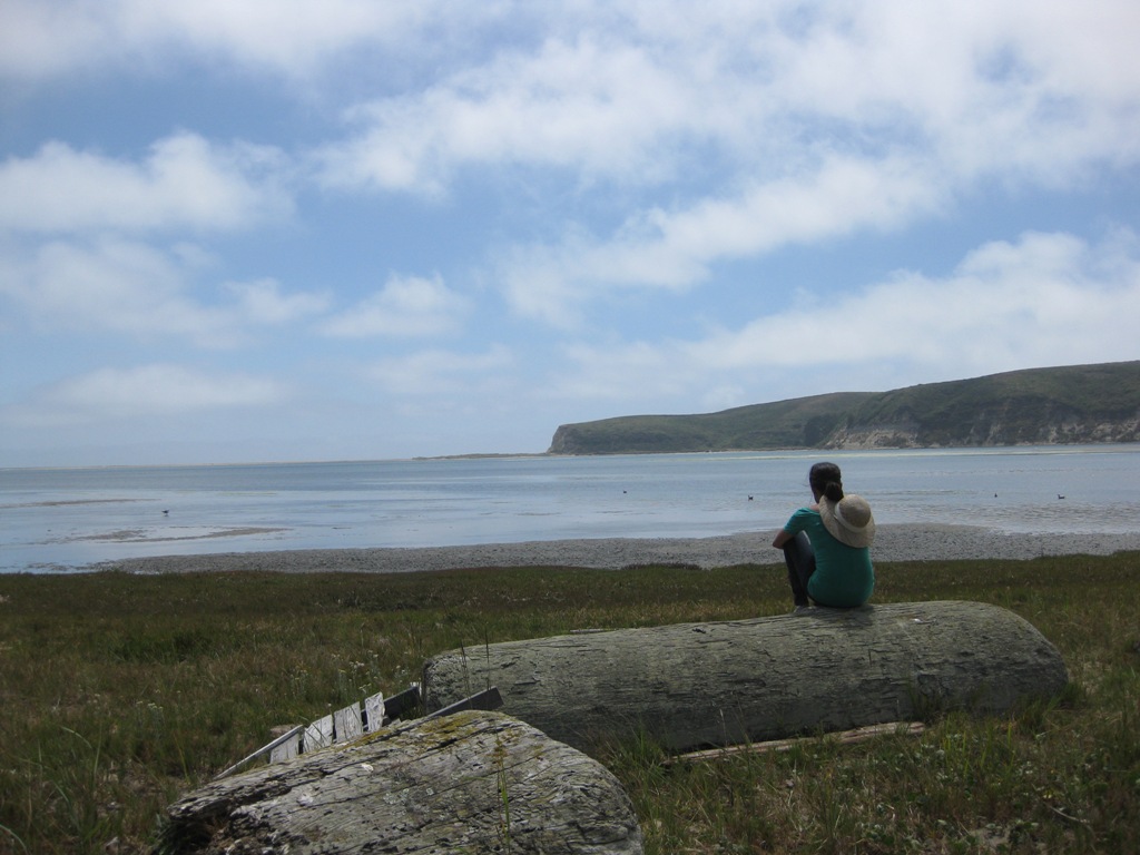 The end of the hike.
 chillin on a bridge across one bay at low tide
Bout to start our hike at Pt Reyes. Can't remember the trail we hiked but it's pretty awesome. hiked over lagoons/bays, and ended up at the ocean.

 Free bikes to use and put back!
Our second day headed to Pt Reyes, but stopped at Muir Woods first. It was super foggy and we couldn't see down the cliffs to the ocean. Then we stopped off in Bolinas, CA first to get gas ($4.09/gallon) and ended up exploring it for a few hours. Small, hippy town with tons of local pride. its pretty awesome!
Subscribe to:
Posts (Atom)